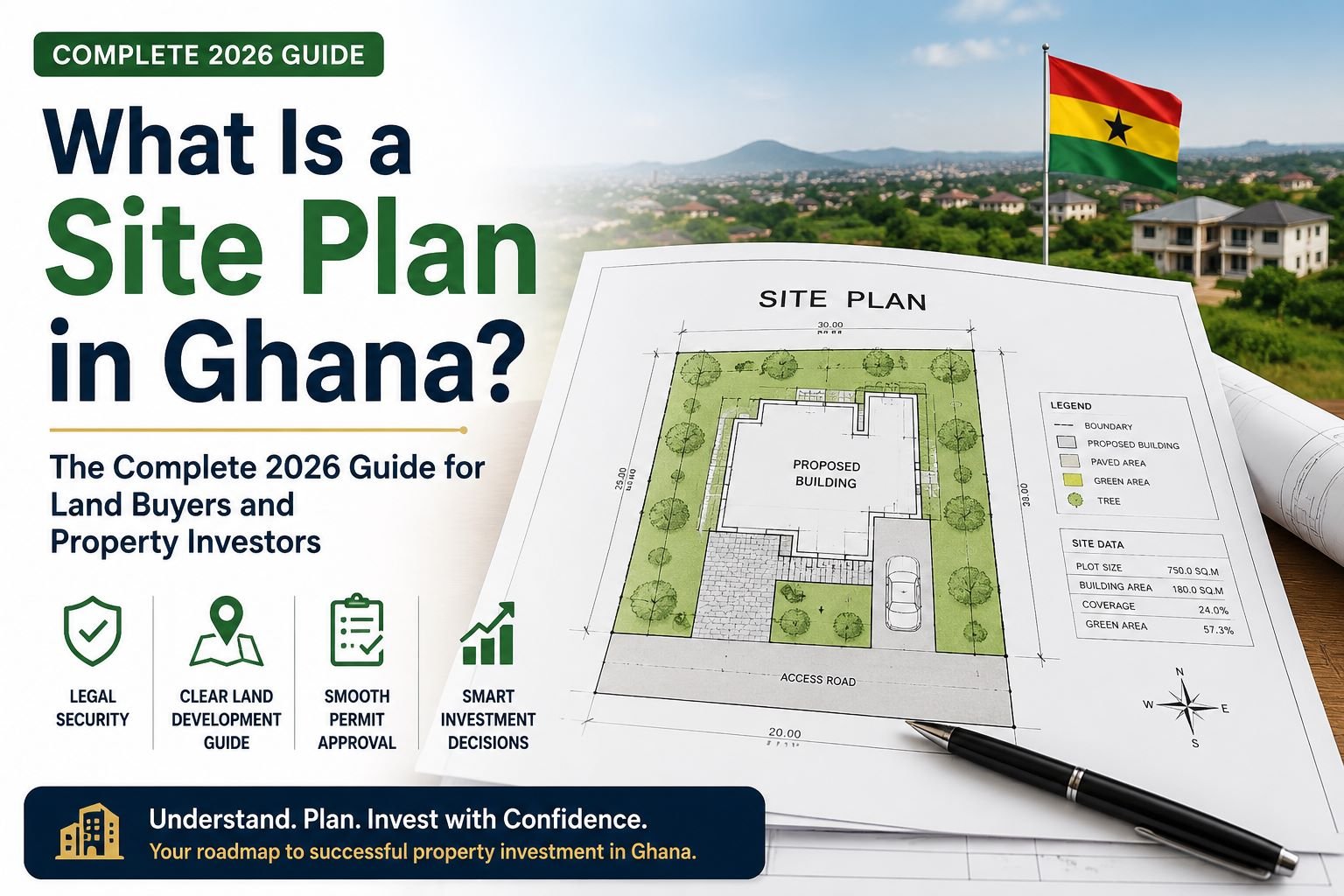
Buying land in Ghana can be one of the smartest investments you will ever make — but it can also become one of the most expensive mistakes if you fail to verify the right documents. One of the most important documents every buyer must understand is the site plan.
So, what is a site plan in Ghana, and why does it matter so much?
A site plan is a detailed survey drawing that shows the exact size, location, dimensions, and boundaries of a piece of land. It acts as the official “map” of the property and helps buyers, surveyors, lawyers, and the Lands Commission identify the land correctly.
In Ghana’s real estate market, a site plan is not just a simple sketch. It is one of the most critical documents required for land verification, land title registration, building permits, and ownership protection.
Whether you are buying land in Accra, Kasoa, Tema, Kumasi, or anywhere else in Ghana, understanding a site plan can save you from fraud, litigation, and financial loss.
At autonaba.com, we strongly encourage every land buyer to verify all property documents before making payment.
What Is a Site Plan?
A site plan is a professionally prepared drawing created by a licensed land surveyor. It shows the physical details of a parcel of land and its relationship to nearby roads, plots, and landmarks.
A proper site plan in Ghana typically contains:
- Plot number
- Boundary measurements
- Land dimensions
- Total land size
- Surveyor’s name and signature
- Date of survey
- North directional arrow
- Nearby roads and landmarks
- GPS coordinates or survey coordinates
Think of a site plan as the “identity card” of the land.
Without it, confirming the true location and boundaries of a property becomes difficult.
Why Is a Site Plan Important in Ghana?
1. It Confirms the Exact Location of the Land
One major problem in Ghana’s real estate sector is land litigation caused by overlapping sales and unclear boundaries.
A site plan helps confirm:
- The exact location of the land
- The true boundaries of the property
- Whether the land matches what the seller claims
Before buying land, your surveyor can use the site plan to physically identify the property on the ground.
This reduces the risk of buying land already sold to another person.
2. A Site Plan Is Required for Land Registration
If you want to register land at the Lands Commission Ghana, a site plan is mandatory.
Without a valid site plan:
- Your land registration may be delayed
- Your land title application may be rejected
- Ownership verification may become difficult
The Lands Commission relies heavily on survey information to confirm land ownership records.
3. It Helps Prevent Land Disputes
Land disputes remain common in Ghana, especially in rapidly developing areas.
Many of these disputes happen because buyers fail to properly verify site plans before making payment.
A properly verified site plan helps:
- Prevent boundary conflicts
- Reduce encroachment issues
- Avoid double sales
- Protect your investment
At autonaba.com, we advise buyers never to rely solely on verbal directions or physical inspections without proper documentation.
4. It Is Needed for Building Approval
Before constructing a house or commercial property, your architect will need the site plan to prepare building drawings.
District Assemblies and Municipal Authorities also require it before approving building permits.
A site plan helps ensure:
- Your building fits within the correct boundaries
- You comply with zoning regulations
- You avoid building on road reservations or restricted land
Without accurate measurements, construction mistakes can become very costly.
Who Prepares a Site Plan in Ghana?
A licensed surveyor prepares the site plan after physically measuring the land using professional surveying equipment.
The surveyor then creates an official drawing showing:
- Distances
- Coordinates
- Boundaries
- Orientation
It is important to work with qualified professionals because fake or inaccurate site plans can create serious legal problems.
Site Plan vs Indenture: What’s the Difference?
Many first-time buyers confuse a site plan with an indenture, but they serve different purposes.
Site Plan
A site plan shows:
- Where the land is located
- The size of the land
- The boundaries and measurements
Indenture
An indenture is the legal agreement that transfers ownership from the seller to the buyer.
In simple terms:
- The site plan identifies the land
- The indenture proves ownership
Both documents are important during land registration.
How to Verify a Site Plan in Ghana
If you are buying land, verification is extremely important.
1. Conduct a Search at the Lands Commission
Visit the Lands Commission to confirm:
- Plot details
- Ownership records
- Survey information
- Coordinates
This helps ensure the land is genuine.
2. Hire an Independent Surveyor
Never depend entirely on the seller’s surveyor.
An independent surveyor can:
- Confirm the boundaries
- Verify coordinates
- Check for overlaps
This extra step can protect you from fraud.
3. Check for Land Overlaps
Ensure the land does not overlap with:
- Government land
- Road reservations
- Waterways
- Existing titled properties
Land overlap issues are one of the biggest causes of litigation in Ghana.
Common Mistakes Buyers Make
Many buyers lose money because they ignore important verification steps.
Common mistakes include:
- Paying before checking the site plan
- Using photocopied documents only
- Ignoring boundary pillars
- Failing to conduct Lands Commission searches
- Relying on verbal descriptions like “the second plot after the junction”
Always request original documentation and verify everything independently.
How Much Does a Site Plan Cost in Ghana?
The cost of preparing a site plan varies depending on:
- Location
- Surveyor fees
- Land size
- Accessibility of the area
In major cities like Accra and Tema, survey fees are often higher than in smaller towns.
However, the cost of a proper site plan is very small compared to the financial loss that can happen from buying a disputed land.
Can You Buy Land Without a Site Plan?
It is highly risky to buy land without a site plan.
Buying land without a site plan is like buying a car without checking the registration number.
You may end up with land that:
- Cannot be registered
- Has ownership disputes
- Overlaps another property
- Faces legal challenges
A verified site plan gives clarity and legal protection.
Red Flags to Watch Out For
When reviewing a site plan, be cautious if you notice:
- Missing surveyor signature
- No coordinates
- Altered measurements
- Inconsistent plot numbers
- Poor-quality photocopies
- No survey date
These may indicate fake or outdated documents.
Why Smart Buyers Verify Before Paying
Real estate fraud continues to affect many buyers in Ghana.
The smartest buyers always:
- Verify site plans
- Conduct Lands Commission searches
- Hire independent professionals
- Confirm boundaries physically
At autonaba.com, we believe due diligence is the best protection in real estate transactions.
Our Parting Word
So, what is a site plan in Ghana?
A site plan is an official survey drawing that shows the exact boundaries, measurements, and location of a parcel of land. It plays a critical role in land verification, ownership confirmation, building approval, and land registration.
If you are buying land in Ghana, never skip site plan verification.
A small investment in proper documentation today can save you from major legal and financial problems in the future.
To learn more about property buying, land verification, and real estate tips in Ghana, visit autonaba.com for trusted property insights and listings.
Disclaimer
This article is for informational and educational purposes only and does not constitute legal advice. Land laws, registration procedures, and documentation requirements in Ghana may change over time and may vary depending on individual circumstances. Readers are advised to consult qualified legal and surveying professionals and verify all documents with the Lands Commission Ghana before making any property-related decisions. Autonaba.com is not responsible for any loss, dispute, or damages resulting from reliance on this information.